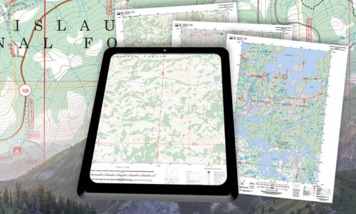
Montgomery, AL – The U.S. Forest Service has launched a new resource for outdoor enthusiasts, offering free access to a wide collection of digital maps on the Forest Service Digital Maps website. These maps, available in various scales, provide essential information such as topography, hydrography, and vegetation, and are perfect for back-country navigation. The maps are geo-enabled and can be downloaded for offline use on mobile devices.
Updated annually, the digital maps are produced automatically using publicly available data from partner agencies and corporate datasets. Users are encouraged to provide feedback about map content, which helps ensure accuracy and continuous improvement.

While these digital maps offer a convenient option, they do not replace the traditional printed Forest Visitor Maps, which remain available at Forest Service Visitor Centers and the USGS Store. The new digital service increases transparency, consistency, and ease of access, enhancing the public’s connection to America’s forests.