OXFORD, AL — The City of Oxford has released the results of its “Oxford on the Move: A Plan for Bike and Pedestrian Routes” study, with one of the most ambitious concepts involving how to safely connect Historic Main Street to Choccolocco Park across Interstate 20.
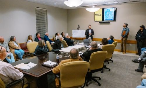
The results were presented during a special Oxford City Council session on Tuesday, February 24, 2026, at Oxford City Hall.
David Coggin of Sain Associates reviewed findings developed through public input, surveys, and a public engagement meeting. Residents were asked where they currently walk and bike, where they feel unsafe, and which destinations they would like better connected.
The completed study evaluates bicycle and pedestrian opportunities across all local roadways within Oxford city limits and establishes a long-term roadmap for expanding active transportation infrastructure.
I-20 Identified as Primary Barrier
A major focus of the study is addressing Interstate 20, which planners identify as the primary barrier between Historic Downtown Oxford and Choccolocco Park.
Six potential connection routes were evaluated. Among them:
-
Route 1: Utilizing an existing five-section box culvert beneath I-20
-
Route 6: Constructing a new grade-separated pedestrian bridge over I-20
-
Additional routes involving interchange crossings, Barry Street, or potential rail-to-trail concepts
According to the study, Route 1 and Route 6 best represent the goals of the plan, though both present challenges.
The culvert option would require hydraulic studies, coordination with ALDOT, and a flood monitoring and closure system, as culverts are designed primarily for drainage rather than pedestrian travel. The bridge option would avoid flood-related concerns and create a highly visible recreational landmark, but would carry significant construction costs.
The study describes the new bridge concept as a potential “major statement of Oxford as an outdoor recreation hub.”
Floodplain and Environmental Realities
The report acknowledges that nearly all connections to Choccolocco Park, Oxford Lake Park, Freedom Park, and Liberty Park lie within floodplain areas. Past flooding events were documented during the planning process.
As a result, natural-surface trails are not recommended due to maintenance concerns. The study favors asphalt or concrete construction where feasible and outlines environmental considerations, including wetlands, streams, historic assets, and underserved census tracts.
Existing Infrastructure and Gaps
Oxford currently has more than 30 miles of sidewalks or pedestrian paths, concentrated primarily in downtown areas, parks, and newer residential developments.
However, the study notes there are currently no exclusive on-road bicycle facilities within the city limits. While bicycles are legally permitted in the right travel lane of non-freeway roads, no dedicated bike lanes currently exist.
The report highlights Oxford City Schools’ mountain biking program, the Coldwater Mountain trails nearby, and the pump track that opened at Liberty Park in June 2025 — underscoring active cycling interest despite limited infrastructure.
Economic and Retail Connectivity
In addition to recreational access, the study links active transportation improvements to economic development. Proposed connections would improve access between:
-
Historic Main Street Oxford
-
Oxford Lake Park and Civic Center
-
Freedom and Liberty Parks
-
Choccolocco Park
-
Quintard Mall
-
Oxford Exchange
Planners note that better connectivity could provide alternative transportation during large events at Choccolocco Park and strengthen Oxford’s positioning as an outdoor recreation destination.
Regional Trail Vision
The plan also considers Oxford’s role in broader regional trail systems. It references:
-
The Chief Ladiga Trail extension
-
Sweet Trails Alabama initiative
-
Visionary bicycle corridors connecting Anniston-Oxford to Cheaha State Park, Talladega National Forest, Gadsden, Piedmont, and beyond
This places Oxford within a larger long-term conversation about statewide bicycle and pedestrian connectivity.
Equity Considerations
The prioritization process gave additional weight to census tracts identified as underserved communities, particularly areas with higher poverty rates and greater numbers of households without vehicles. The report notes that improved walkability in these areas can reduce car dependency for essential trips such as school, groceries, and medical appointments.
Phased Implementation
Projects are organized into short-term, medium-term, long-term, and visionary phases. Adoption of the plan would not immediately authorize construction but would establish a framework for pursuing federal, state, and local funding opportunities as they become available.
The city council will now review the study before deciding on formal adoption.
If adopted, “Oxford on the Move” would serve as a living document guiding bicycle and pedestrian infrastructure improvements for years to come.